General Information
Batanes Islands is a province located at the Northernmost tip of the Philippines. It is about 190 km south of Taiwan. The smallest province in the Philippines in terms of size and population, its three largest islands are Batan, Itbayat and Sabtang. The people of Batanes are called Ivatans and the main languages spoken are Ivatan (spoken in Batan and Sabtang) and Itbayaten (spoken in Itbayat). Majority of the Ivatans are fishermen and farmers.
The climate is subtropical and it has no particular wet and dry season. Summer is from April to June and winter is from December to February.

Day 1
This is technically already day 2 of our scheduled trip to Batanes Islands but because of an unfortunate and inconvenient circumstance with SEAIR, all of us 33 passengers were held back by a day. I might write a full article on this in one of my future posts.

In less than 5 minutes from the airport, we were at the town center and in less than 3 minutes we were in our pension house. We checked in, had a short nap, changed our clothes. The moment we stepped out of the inn, it started to pour. Just our luck! In a matter of minutes, the weather shifted from extremely hot to massive rain! Our guide told us not to worry because it is a normal thing that will pass in about 10 minutes. Sure enough, it did.
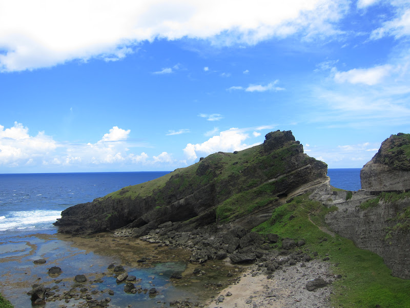
A few minutes' drive from the inn, we reached Chawa view deck. It has a small grotto along the highway. Here, we had our first glance of the
very photogenic view of Batanes Island. There is a viewing deck with cement
benches. To reach the sea, one has to go down a flight of stairs with
approximately 103 steps down. The remaining few steps can be a bit slippery so
it is best not to go all the way down.


We then drove past the Shelter port.
This is where boats are parked to protect them from huge waves during storms. I found it to be ingenious and aesthetically pleasing at the same time.

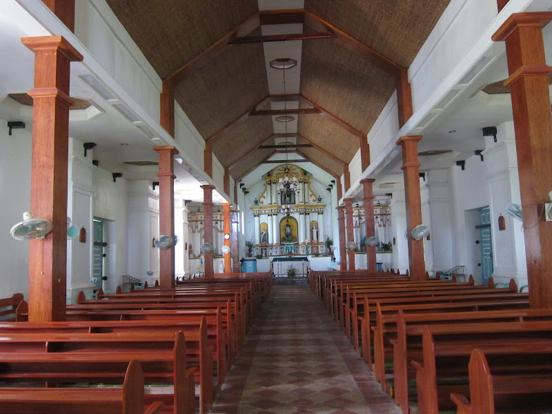
Next stop was Mahatao town.
We registered first and paid a Php50.00 fee per person before entering the
town. The nearby San Carlos Borromeo
Church, more popularly known as Mahatao Church, was built in 1787. It was ravaged
by a storm in 1872, rebuilt in 1873 by P. Cresencion Polo, O.P and was declared as a National Cultural Treasure by
the National Museum in July 31, 2001.

Next was the infamous "Marlboro Country", formally know as Rakuh-A-Payaman. This is where I fist stepped foot on Batanes Island's mountainous terrain. By this time, it was already sunny again. There are small huts where people can rest. There is a restaurant at the entrance as well but it is mostly closed unless there is an advance food order from the tour guides. The hills itself is a wide field of grass where cows, carabaos, goats and other animals are brought by the farmers to graze. I have never seen grass so green in such a wide area…farther than my eyes can see, and so well maintained…no need for trimming because the animals do it for them!
Although it was sunny, I never felt uncomfortably hot because of the strong wind coming from the deep blue Pacific Ocean.


Next was Blue Lagoon. The 10-minute easy trek down to the rocky beach is worth it for those seeking for a private swimming experience. This is where Spanish friars used to bathe because they did not want to mix with the locals in the open beaches.


Both the Blue Lagoon and the White beach have no shower facilities.
Lunch was in Vatang Grill and
Restaurant. Only the narrow road separates it from a beach with cream sand so
the dining experience includes relaxing to the sound of the ocean waves. The
interior is very basic. The inside of the roof is lined with the thin bamboo
that is typical of a lot of the structures that I have seen. As we settled down
on our table, the staff played a video of Batanes Islands made by the local tourism.
I wanted to try some of the local dishes but all of them had to be ordered a
day in advance.

For lunch we had Chopsuey, Chicken in honey sauce, sweet and sour fish and a fish hotpot (no photo of the hotpot here). All of the dishes tasted good and home cooked. The serving sizes are big. If it says in the menu that it is good for 4 persons, it really is. My favorites were the chicken with honey sauce, which was similar to lemon chicken but not as sweet, and the fish hotpot dish with a hot broth, lightly fried maya maya fish, ginger, scallions and vermicelli. Our total bill was less than Php800.00 for 4 persons. Now thinking about it, I think we ordered too much food! :)


After lunch, we dropped by the Honesty Coffee Shop where "Honesty is the best policy". The unmanned store is owned by Elena Gabilo. The store has very basic merchandise, mostly food, drinks and souvenir items. I have never heard of any other store in any other country doing the same thing.
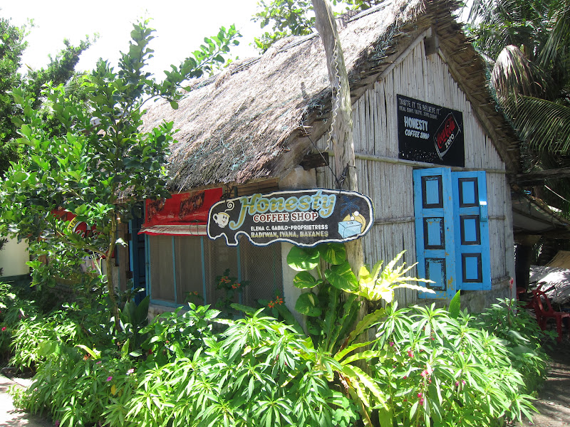
Once you have decided on what to buy, you are to drop your payment in the wooden box and jot down what you bought. There is a message posted by the owner...

We then drove past the Songsong
Ruins (Ghost town). These ruins are what is left of the traditional stone houses along the
beach that was struck by the Tsunami in the 1950’s. There have been no
residents in this area since.

Next stop was the Alapad Gorge which offers a view of the LORAN (Long Range Aid to Navigation). The LORAN used to be a US facility used to navigate ships and aircrafts.


After taking a quick photo
of our last stop, the San Lorenzo Ruiz church, we headed back. It was 3:30 in
the afternoon. Along the way I noticed several men on the beach carrying
nets attached to long wooden sticks. I thought they were doing Sudsod, a way of catching shrimps in
mangroves, like what I’ve tried in Donsol. Apparently, these men were trying to
catch small squid. I’m very curious, I
want to try this next time.


...to be continued...
No comments:
Post a Comment